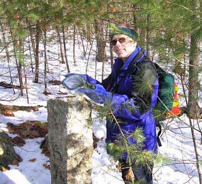
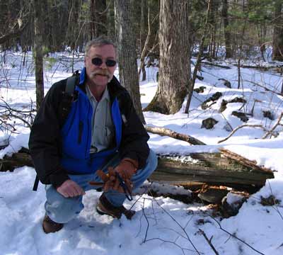
Beaver Brook - February 3, 2008
Activity, photos, and report by Ken L.Back to
Beaver Brook...
...with me, myself, and I! There was some interest by
others, but in the end it was just yer ol' Get Outdoors New England
Webmaster.
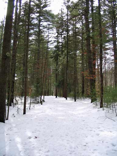 |
The weather was cloudy with a little sun here and there, temps in
the upper 30s or maybe a little more, no wind to speak of. Given
the ice storm two days earlier, the ground was questionable, so Your
Webmaster got out his crampons. It turned out to be a good choice
for the route chosen, although throughout the woods one could have
gotten by with snowshoes or even x-c skis. Heck, even just boots
if you didn't mind slipping a little. The main trails are fairly
well packed down, but I tried to avoid those. :-) My trek took
me way out to Rte. 130 where one normally crosses the road to get to
Wildlife Pond. Given that I didn't have snowshoes and the trail in
that section had not been packed down, I decided to take a right onto
130 and head down to the other entrance to Beaver Brook. It was a
good thing I had my crampons, as the side of the road was ice, and I
stuck to it like glue.
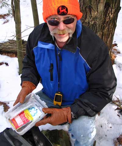
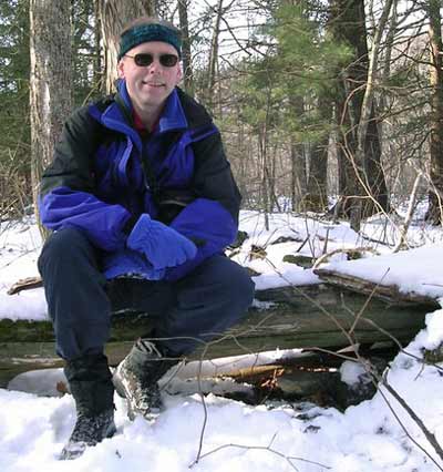
During my Beaver Brook outing I encountered several people, including
someone with two Newfoundlands that liked to wade in the water. I
was so intrigued by the big dogs that I forgot to grab some photos!
They were very fuzzy and very friendly.
It was a nice walk, and I made it home in plenty of time for the big
game...uhhh...unfortunately. :-) |
| Next time... |
|
|
 |
 |
|
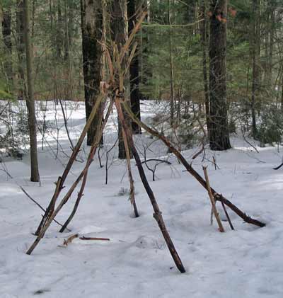
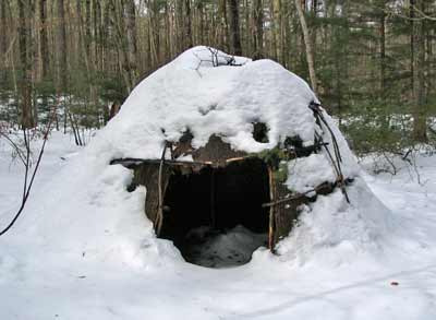
Turn THIS... |
...into THIS! |
|
Boxford State Forest - January 26, 2008
Activity, photos, and report by Ken L.
Additional photos by Dave J.The weather was pretty good - sunny, no
wind, and probably in the low 30s for temperature. Your Webmaster
pulled up to the Sharpner's Pond Road parking lot for the Boxford State
Forest, and right after him was Dave J.
We opted to head out in our hiking boots. One could
have used snowshoes, as in many places there was a few inches of powder.
Cross-country skis could have been used in most places, but a lot of the
roads and trails had rocks showing. And in some places we had some
ice, and crampons would have been nice every now and then, but it wasn't
like we were crossing swamps or anything...or were we...?
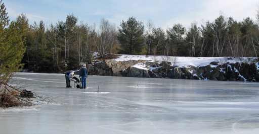
The Boxford State Forest was a proposed NIKE (nuclear
missile) site. In fact, work began, but funding was cut. Near
the parking lot is the old missile silo, never completed. It has
filled with water, and we ran into two guys ice fishing. They said
that there's some bass in the old silo.
| As we recall from earlier trips to Indian Ridge (Andover, MA) and
the Middlesex Fells (Melrose, MA), Dave enjoys geocaching. I
thought it would be a splendid idea to try to find some of the caches in
the Boxford State Forest---some of them are deep in the woods and are
reachable only if you bushwhack, and that is not something you want to
do in the warmer weather because of the insects. It turns out that the
caches Dave wanted to find were in my GPS receiver already, so off we
went.
 |
 |
|
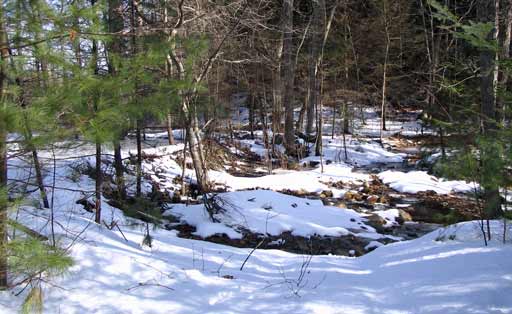
We wandered off one of the main
trails to track down one of the bushwhack caches. It led us down
to a swamp. It was at that point where Dave's GPS receiver and
mine began disagree...wildly! His pointed in one direction, mine
the other. We decided to follow my GPS receiver for the moment,
and it was sending us across the swamp (of course). Instead we
decided to go around the edge.
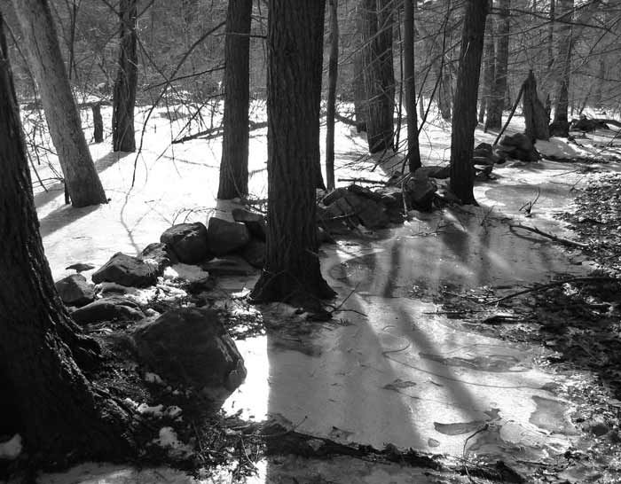
The beavers have been busy, and
they have been flooding various areas in the forest. You can see
the old stone wall above heading into the water, and below you can see
what used to be the road.
The beaver dam is on the left, and
it has certainly grown over the years!
|
 |
We bushwhacked around the swamp and back to the main road. We
then had to go back toward the swamp to fine one of the caches.
Success! But...Dave's GPSr, which had pointed in a different direction
earlier, was still pointing in a different direction! Dave looked
at his GPS and realized that we had our GPS receivers set to two
different caches. Well, now, that would certainly explain why
his GPSr wanted to go one way and mine another!
But that means, of course, there's still another cache out there
located deep in the woods far from any trail...
We wandered back to the main road where we met two other geocachers
and chatted with them for a few minutes. They were heading where
we had just been, so we apologized for the footprints which are a dead
giveaway in the snow. :-)
|
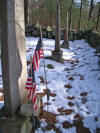 |
I always stop at the old cemetery (click the thumbnail for a larger
image). The people who built the farmstead in the Boxford State
Forest took part in the Revolutionary War. When there I like to
acknowledge the sacrifice of them and many others who bravely took up
arms to set the Colonies free from British rule. |
After our pause at the cemetery for a sit and a few snacks, Dave and I
wandered the main road back out to the cars to end the day.
The Boxford State Forest doesn't offer too much in the way of scenery per
se, but it an enjoyable, quiet place to walk, you can get a few miles in,
you can pick up a few geocaches, and you can search out the old
Russell-Hooper farmstead.
|
Mt. Tom Hike - January 20, 2008
Activity, photos, and photo captions by Barbara D.
 |
Barbara & Co. intended to do Mt. Moosilauke, but the
weather for that mid January weekend was to prove daunting - cold temps
and high winds. The group opted for the more tame Mt. Tom instead,
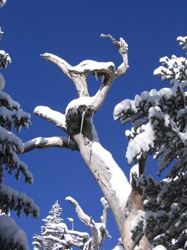
and they were certainly not disappointed. Although the morning started
out very cold, the sky was an amazing blue.
In fact, the original image, if enlarged, shows white specks:
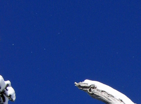
Are these stars visible in the daylight? Or is
this simply snow whipped up by the wind or dust on the camera lens? |
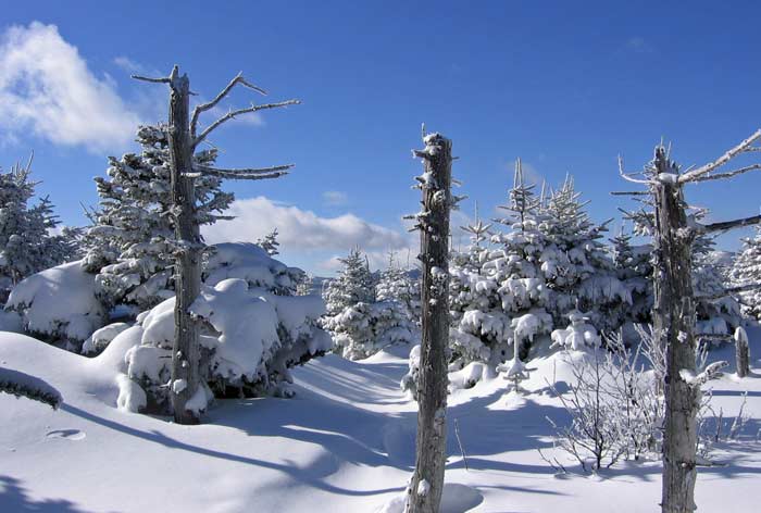
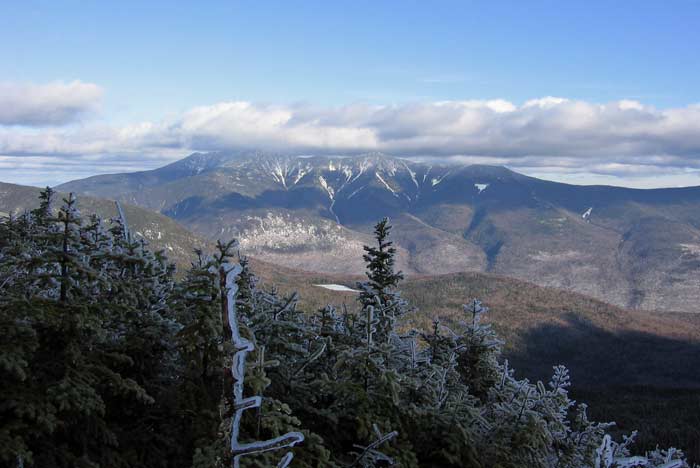
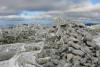
Fresh snow on the Mt. Tom summit area before the group
broke trail to the southwest
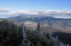
view to the Pemigewasset Wilderness
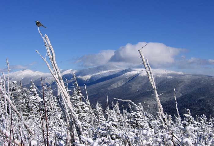
Expansive view northeast to the Presidential Range
...and one very chilly gray jay :-) |
Mt. Kinsman Hike - January 12, 2008
Activity, photos, and photo captions by Barbara D.
 |
Barbara does some amazing hikes and sends in some spectacular
pictures. On the 12th Barbara and Michael hit the trail to Mt.
Kinsman. There was no soft powder that day, just hard packed snow
on the trails and beautiful ice-coated branches along the Kinsman Ridge
Trail. |
 Thanks to no wind, Barbara and
Michael were able to relax with their lunch on North Kinsman, enjoying the
view across the notch to Franconia Ridge.
Thanks to no wind, Barbara and
Michael were able to relax with their lunch on North Kinsman, enjoying the
view across the notch to Franconia Ridge.
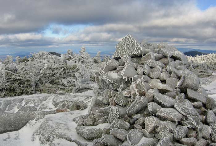
 The summit cairn on South Kinsman.
(Click the thumbnails for larger photos.) |
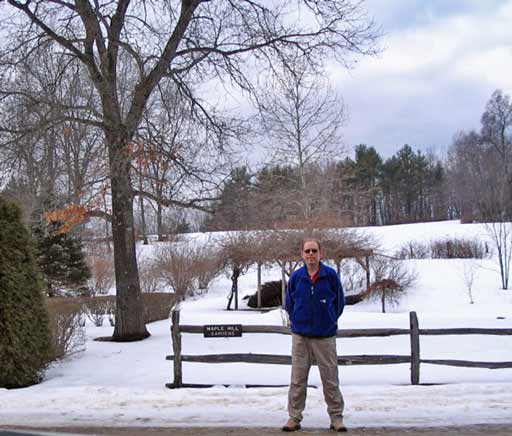
X-C Ski at Windblown - January 6, 2008
Activity and trip report by Ken L.Yep, it was time for Your
Webmaster to get back on his cross-country skis and check out the
Windblown X-C Ski Center in New
Ipswich, New Hampshire.
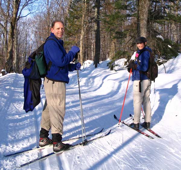
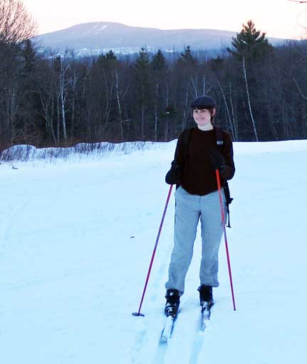
Your Webmaster and Susan out on the trail
Although several people showed interest, one person decided
to shovel off a roof instead, someone else overslept (!!??), and
unfortunately someone else had car trouble. Ugh.
Well, I'll try not to rub it in, but, yes, it was a nice day
for Susan and me. I picked Susan up from a nearby commuter rail
station, and off we went to New Ipswich. Susan rented some gear, and
we got on the trail around 10:30. The day started out rather cloudy,
but later on the sun came out. The temperatures were fine all day, and
there was no wind. Conditions overall were pretty good, and since
Susan hadn't done much x-c skiing (ever) and I've been way out of practice,
it was nice having the trails in our favor.
 |
Windblown is not a huge cross-country ski center when
compared to, say, Jackson or Bretton Woods, but it has a nice lodge
where you can rent equipment for the day if you need to, get a bit of
chow if you get hungry, and warm up by the fireplace. They're also
not a very far jaunt for those of us in southern New England, which is
probably why the ski center is often crowded, according to my co-worker
Melanie (who noted that the parking lot sometimes overflows to the
street). I'd say that it was "busy" on the day we were there, and
there were many people in and around the lodge, and we did see several
people on the trail. But it didn't feel overcrowded. Windblown
greets you with about 25 miles of wooded trails (according to their
site), roughly 1/3 green (easy), 1/2 blue (moderate), and the remainder
black (difficult). Generally the trails are all groomed the
same---it's the size and steepness of the hills along the way that make
for the difference in difficulty. They have snowshoe trails as
well as the X-C ski trails, and the Wapack Trail with its yellow
triangle blazes snakes through the ski area.
The snow conditions for the day were good with just a little melting,
and the trail grooming was quite nice and held up great all day.
Toward the end of the day, however, the trails started icing up, making
for some interesting downhills. |
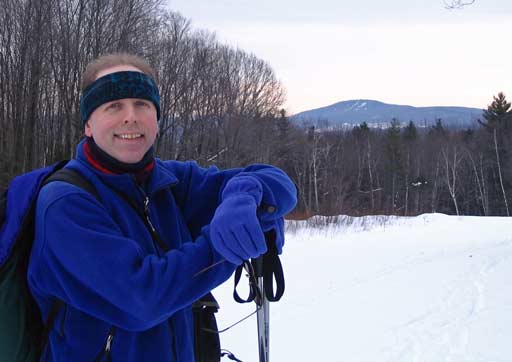
Susan and I were treated to a nice sunset late in the day as whatever clouds
were around broke up even further and the sun began to slip behind the
hills.
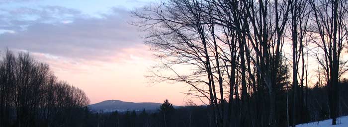
By the time late afternoon rolled around...
...Susan and I reviewed the map and realized we had covered most if not all
of the moderate trails and many of the easy ones. The black ones?
Well, OK, we'll leave those for another time.
With Susan well ahead of me and safely out of the way, Your Webmaster
negotiated the last icy downhill before the lodge, and that was it for the
day. |
|