Crotched Mountain - June 19, 2005
Activity by Ken L.
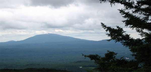
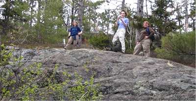
Mt. Monadnock
A cloudy day was in store for GONewEnglanders Jen, Tom, and
Your Webmaster when we went over to Crotched Mountain. There were even
some showers in the area:
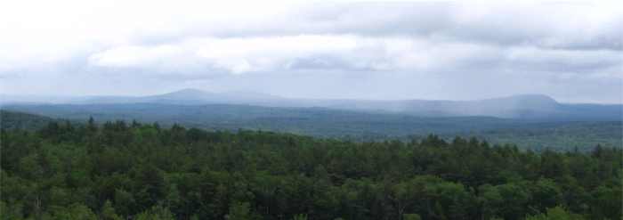
It's neat when you can see the rain showers elsewhere in the
area--as long as they're not heading your way! Fortunately we stayed
dry.
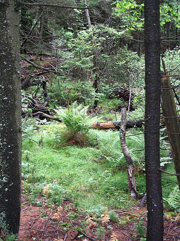
Along the way we saw the usual critters:
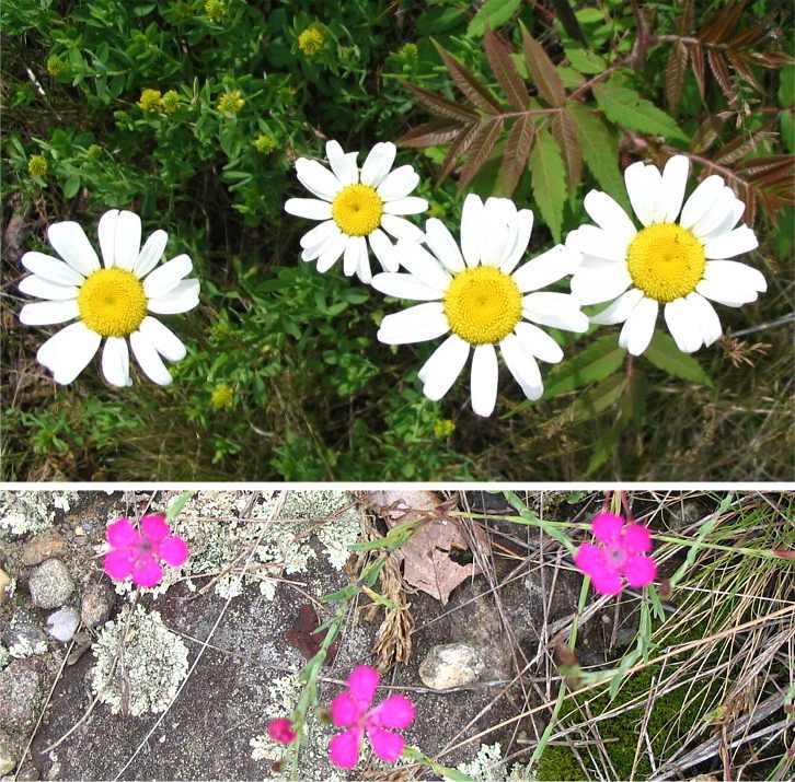
...and some flowers and other vegetation:
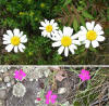
Check out the purple flowers in the picture on the left
(click for a larger image). Those flowers are almost painful to look
at they are so vivid! Bees see colors that we cannot, and it's almost
as if those purple flowers are right at the edge of our visible spectrum.
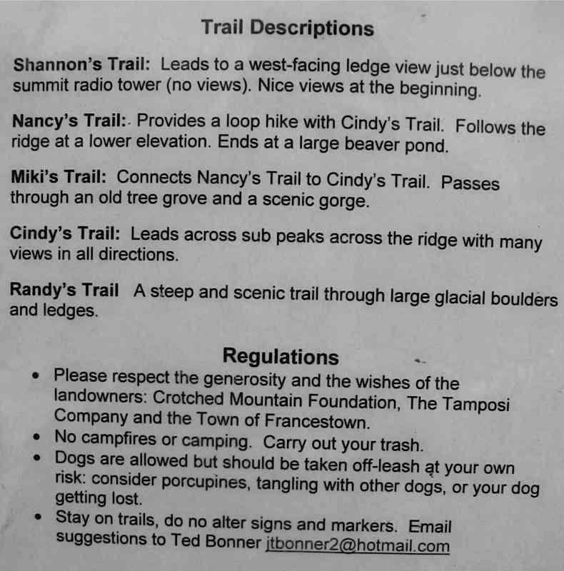
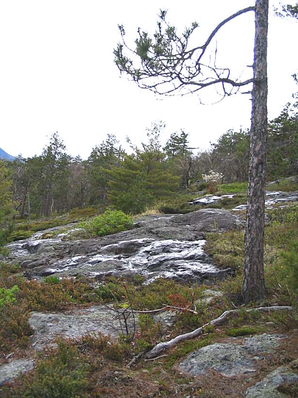
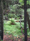
The Crotched Mt. trail system (courtesy of Ted Bonner) is
designed for maximum views and to explore the interesting things on that
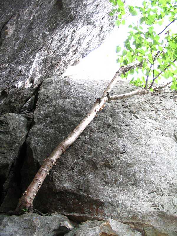
side of the mountain, such as this glacial erratic:
Yep, it's just a huge stone perched up there.
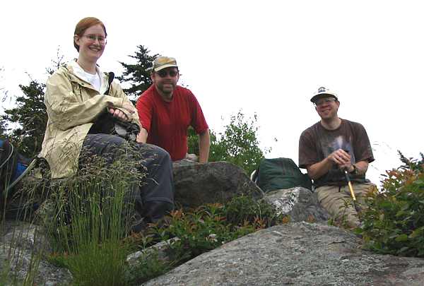
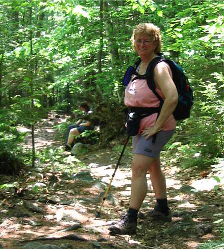
Jen, Your Webmaster, Tom
It was another pleasant GONewEngland outing!
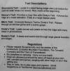
For your reference, here is a copy of the information at the
trailhead.
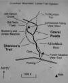
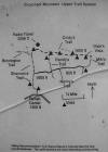
Our route (click the map in the middle): The trail
starts across the street from the Rehab Center (follow the trail through the
woods so you can walk through the meadows--click the map on the left),
Shannon's Trail to the top (for snacks), Cindy's Trail, Dixie's Vista (a
little side trail), Miki's Trail, then a right onto Nancy's Trail, back to
Shannon's Trail and back out. |
Morgan-Percival - June 5, 2005
Activity, photos, and report by Ken L.
Additional photos and material from Martin K. and Rosie
Your Webmaster, Dawn S., and Dayhike with Deb's
Deb started the loop hike to cover Mts. Percival and Morgan in the Lakes
Region of NH.
 <-- Deb and Dawn pause for a second or two along the trail.
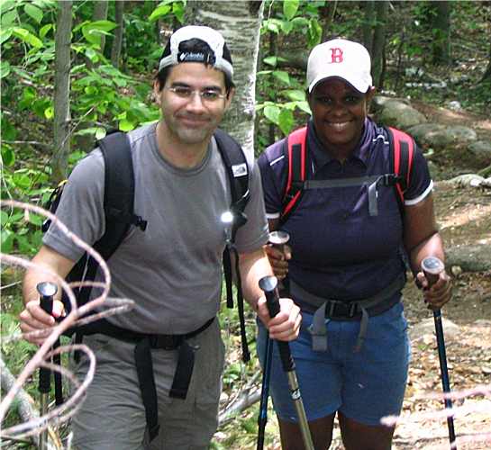
Martin and Rosie caught up with us on
the way up. -->
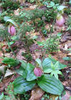
| Flora and Fauna
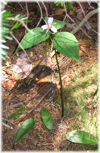 |
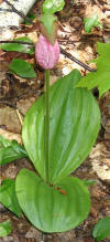
The usual springtime flora greeted us on the way up.
To the left is trillium, and below is a ladyslipper.
 (click for a larger image)
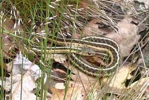
Martin and Rosie encountered some fauna on the way back:
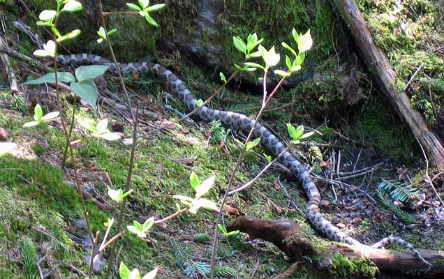
They correctly avoided this fellow, believing it was a
rattler. Fortunately it only looks like one--it's a harmless milk
snake. Still it's best to steer clear of all snakes. Usually
they'll do their best to steer clear of you--they want nothing to do
with people. |
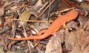
The "fun" way along the loop includes the rock fall caves.
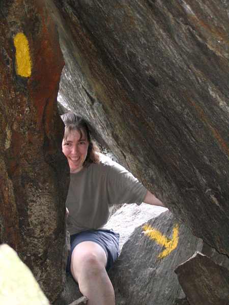
They're quite cool (for climbing through and for
temperature.)
Enough sunlight gets through to let this guy grow inside the caves!
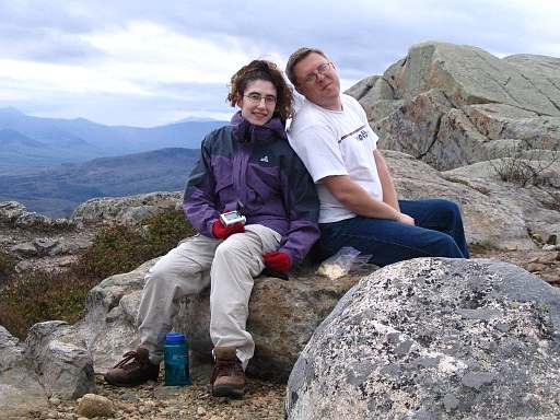
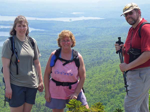 <-- Dawn, Deb, and Your Webmaster at the summit
A happy group of hikers!
After the hike, Martin (who's a fish) went swimming with
Rosie at Squam Lake, which is nearby. Heh, he adds that he and Rosie
have been counting many mosquito bites! Ahhh, hiking in June...:-) |
Bartlett Inn Stay - May 20-22, 2005
South Moat - May 21, 2005
Activity by Ken L.
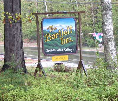 |
We were off again to the
Bartlett Inn in Bartlett, NH
for another relaxing weekend. Your Webmaster arrived late on
Friday evening to greet Motivator and Welcoming Committee Kathy K.,
Michelle and her sister Corine, Ruth, Patty, Dan, and Rachel. We were the only ones at
the Inn, except for innkeepers Nick, Miriam, and Samantha (who's a
little character and is just now beginning to stand and is almost
talking). For the uninitiated, the Inn is not far from Attitash.
The Inn has a few rooms to stay in, a dining room (for yummy
breakfasts), a decent sized room with a wood stove which is a good place
to gather. There are cottages as well, and dogs are allowed,
although we didn't have any with us this time.
We almost got Nick to hike with us on Saturday, but he and Miriam had
to prepare for another group that would be staying over on Saturday
night. |
After breakfast on Saturday folks pondered what
hike we'd get motivated to do. As you may recall, there was a lot of
rain during the latter part of May in New England, and this was about the
start of the nor'easter that just churned and churned over most of New
England for a week. Saturday started out sunny, but it quickly clouded
over with rain in the forecast for late in the day and for the rest of the
weekend.
We split into two groups. Ruth and Kathy hit
North Moat (about 8 miles round trip), and the rest of us went over to South
Moat (about 5 miles round trip without as much elevation). The Moats
make up a range that sticks up from nowhere west of the Saco River in the
Conways. It can be hiked end-to-end about 9 miles from Diana's Bath to
a trailhead not far from the Covered Bridge Campground off the Kancamagus
Highway.
The one thing about the Moats, though, is they are
relatively steep.
 So those of us on South Moat took our time (not Kathy and Ruth, I'm sure, as
they're little Energizer Bunnies).
So those of us on South Moat took our time (not Kathy and Ruth, I'm sure, as
they're little Energizer Bunnies).
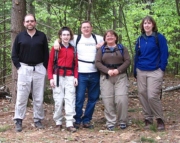
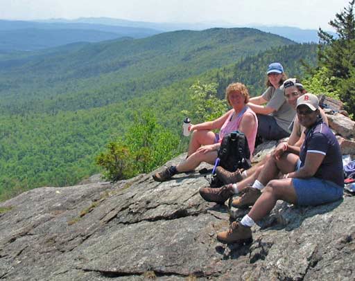
Your Webmaster, Rachel, Dan, Patty, and Dawn get ready
to hike South Moat
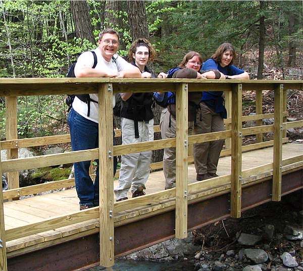
| Folks will want to note that the South Moat trailhead
has been relocated about 1/2 mile down the road from its original start,
and there's a brand new trail to hook up to the old. They used a
Bobcat to carve it out, as it lacks the usual rocks'n'roots of your
usual New England trail. It's a pleasure with the smooth going,
and there's a nice little bridge along the way. But you soon hook up
with the original trail, and the rocks start. Oh well!
 |
 |
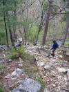
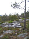
| The trail is a constant and somewhat steep
pitch most of the way. Much of the rock surface is smooth and
slippery especially with the winter run off in places.
 |
Views start about halfway, and the Moats offer perhaps the best view of
North Conway and Conway from pretty much anywhere.
North Conway. You can see Mt. Kearsarge, Mt.
Cranmore, and hints of the shops along Route 16.
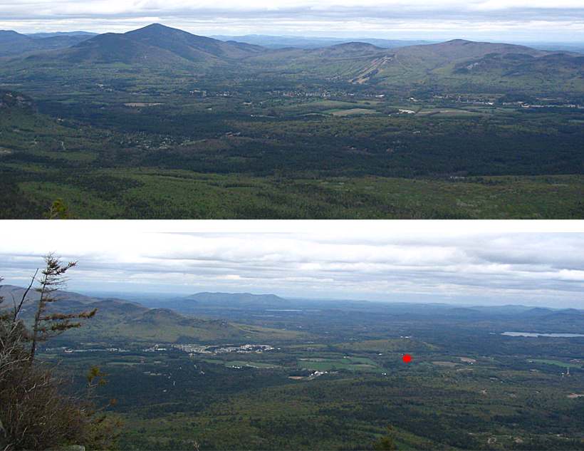
North Conway's last big shopping area as you head
south (just left of center) melts into Conway to the right.
Your Webmaster owns a tiny spot of land where the red dot is.
 |
After a bit of huffing and puffing we made it to the top where it
turned out to be a bit chilly in the wind. By then the sun was
long gone, and we could see some rain showers off in the distance.
We had a bit of lunch then made our way back down to the cars just as
some very light rain started to fall.
Little did we know that the rain would last for more than a week in
the north country. |
On Sunday we all went our separate ways, but with the rain nobody went
hiking. Your Webmaster went over to Lincoln, NH to the Mountain
Wanderer and met Steve Smith, author of several hiking books. He's a
great guy, and I recommend dropping by his bookstore to say hello.
I'll be picking up his new edition of the southern NH hiking guide the next
time I'm in the area.
It was another nice stay at the Bartlett Inn! Great to see my
GONewEngland friends as usual and catch up with the Bartlett Innkeepers.
The next stay likely will be after the foliage season--stay tuned to the ol'
Bulletin Board!
|
|